
Writing with relevance about George Washington is a strange trick. It’s not just that the terrain has been so thoroughly covered, although there is that (as of this writing, Amazon sells 13,172 books with the words George Washington in the title). It is the unique challenge of writing about a jewel of American exceptionalism who was himself genuinely exceptional. There’s the gifted military feinting, the repeated rejection of dictatorship, the young man who treated food and sleep as optional. There are those suspicious intercessions of "providence:" all those horses shot out from under him, and bullet holes in his hats and shirtsleeves. How does one write about a man whose biography matches his hagiography?
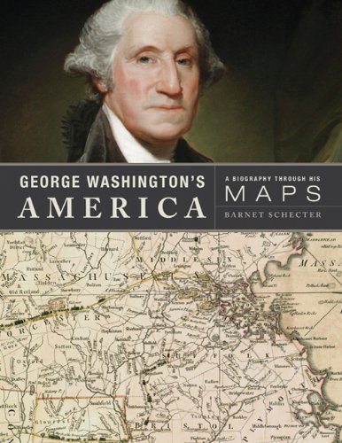
In George Washington's America, historian Barnet Schecter neatly sidesteps this trap by exploring Washington’s life through geography. Maps informed every chapter of his adulthood: surveyor, soldier, landowner, commander, president. By his death, Mount Vernon contained more than ninety maps and atlases, an impressive stockpile for the 1790s. This collection was eventually acquired by Yale, and provides both inspiration and lavish illustration (along with maps from outside the collection) for Schecter's book.
The value of good maps was continually impressed on the young Washington. At sixteen, he was already plotting his own surveys. At nineteen, on a voyage to Barbados, the ship’s captain nearly missed the island because of a navigational error. Decades later, faulty maps sent Benedict Arnold (pre-defection) up the Kennebec River, forcing his thousand-man contingent to sleep in frozen clothes and eat boiled shoes to survive. In the Revolutionary War’s darkest days, Washington kept an eye on his escape route into the jungles of Ohio.
Vital tools in the eighteenth century, maps now provide a glimpse into Washington’s life and the world he lived in. Unfortunately, Schecter seems more interested in them as visual aids to the text than as cultural artifacts. This left me with questions. One exquisite English chart of Bunker Hill—complete with cartoonish little burning houses—appeared eleven weeks after the battle itself. How were such detailed maps produced so quickly? How were they financed, stored, transported? Before Samuel Johnson’s 1755 dictionary penetrated American lexicography, English spelling ran wild. Did word variance ever cause navigation mishaps? On these points, Schecter is mum.
And even as visual aids, the book’s maps aren’t especially user-friendly. Many battle citations in the text refer to charts in different chapters, making the reader flip back and forth. This is unfortunate in a book with so many battles. In 1780, for example, we learn:
Cornwallis marched northward, arriving at Charlotte on September 26, determined to bring North Carolina under British control. Before leaving South Carolina he had dispatched Lieutenant Colonel Patrick Ferguson with a thousand Loyalists to quell the civil war raging in the western counties, where Whig frontiersmen had been relentlessly attacking Loyalist settlements. As he advanced, Ferguson issued warnings and threats, which infuriated the frontiersmen, who rallied a large force and surrounded Ferguson's column at King's Mountain on October 7.
Schecter's war coverage often suffers from such deadening compression. This isn’t a high school history text. Schecter would have been better served by spotlighting just a dozen (or less) battles.
But then there are all those beautiful, beautiful maps. It’s easy to get lost in the otherworldly romance of the eighteenth century when gazing into these gorgeous color plates and insets. Fussy little serifs swoop under baroque cartouches. Tiny Caribbean islands radiate neatly scripted town names. Ornate wind and current notations follow the curve of the Earth’s latitudes. Certain regions appear atrophied, others swollen. Some of the close-ups resemble illuminated manuscripts from centuries earlier: stunning, primitive, and—above all—utterly unrecognizable. This version of America looks like Mordor, or Oz.
Washington’s own surveys are far less flashy, containing only occasional hand-drawn arrows for ornamentation. His interest in rivers—specifically their falls, rapids, and portages—was equally utilitarian, even if his long-term vision was vast. He understood the importance of rivers as roads, and the importance of roads to America (after the war, he marveled at a new ”mechanical boat” that could chug upstream). He grasped the immense value of the land to the West—both the hostile Colonial zones, and the farther regions marked “intirely [sic] unknown.”
And here’s where the book may leave modern readers a bit glum. Washington’s military and political achievements overshadow his success as a booster of American expansion. In his Potomac Canal project—Washington’s “waterway to the west”—one can glimpse the seeds of the strip malls, parking lots, and fast-food monoliths that dot our maps today the way trees dotted his. George Washington’s vision is still with us. His success is our sprawl. In a 1785 letter, he summed up this wondrous, terrible future with a three-word edict from the Book of Genesis: The sons and daughters of this new land, he wrote, should “increase and multiply.”
Sam McPheeters is a freelance writer living in Pomona, California.


